TRANS BATU PUTIH
Trans Batu Putih
(Kuala Woh - Pos Musoh)
(4d 3n) Rating: 9/10 (Hard)
Batu Kak Peak (1,848m)
Batu Putih Peak (2,132m)
Batu Bujang Peak (1,922m)
Batu Dara Peak (1,447m)
Gunung Batu Putih is the 8th highest peak in Peninsula Malaysia (West Malaysia) standing at 6,993 ft (2,131 m) above sea level. It’s situated along the Perak-Pahang border, not too far from KL. It falls just short of being a G7 mountain (7,000 ft and above).
We planned this as a little family trip, so my fiancé Popoi, youngest brother Haikal, and I joined another group.
 |
| The Team GOTMAD-WILDOUTDOOR ADV-PMGM |
This week was a little stressful with work and everything, but the group and guides were a friendly and (Wardah, Yana, Dhia, Kuzam, Amir, Panjang, Zack) and the guys from Wildoutdoor ADV & PMGM Paklee and Boy were helpful and resourceful. I highly recommend anyone to join them.
We met up at Kampung Masjid Batu 3 Tapah and parked there before hopping into a 4 wheel drive. We were greeted by a friendly little Dog who we named Dogo. He would accompany us for the whole trip to make sure we were safe. Dogs are amazing companions and this little fella was so cute!
DAY 1
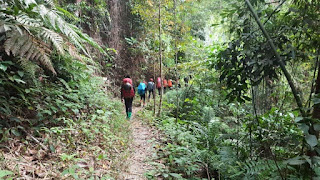
We began the hike at 9.30am at the Kuala Woh starting point. We crossed the River Y and another smaller river before reaching Camp Balak. We took a quick lunch break to refuel. The trek wasn’t too hard, but it got progressively tougher as we moved further along, and we were reminded of our respect for nature when we bumped into a viper snake resting between the trees and trail. Remember to tread carefully, guys!
From Camp Balak to Gua Azan the track was very steep and sometimes felt unforgiving. Never skip leg day at the gym. We reached Gua Azan at around 5pm and called it a day. The water point here is amazing, as it flows through a series of small caves and rock formations. The water was so refreshing and cold.
DAY 2
We woke up to a beautiful sight with surround bird audio. We had a light breakfast with our new friend Dogo and prepped for the hike. Paklee and Boy gave a short briefing and we started off at around 9am.
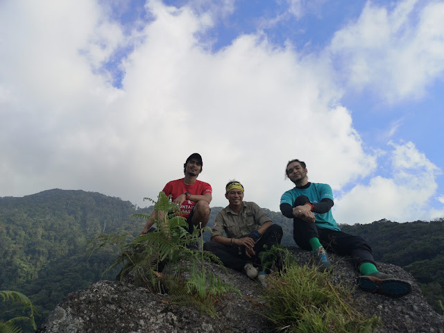
We reached Batu Kak Peak (1848m) after an hour. The climb is steep, so be prepared! The weather was gorgeous and we could fully enjoy the 360 degree view. It’s hard to put into words – you have to see it for yourself. Photos and videos galore!
We continued to the final water point to check out the famous hidden waterfall “Air Terjun Terbunoh”. The name sounds ominous, and I don’t think I want to google how it got its name hehe. Let’s just say it’s really beautiful, but we should always be careful.
Here is where top up our water before proceed to Batu Putih Peak.Bare in mind that from the check up you have to climbed down thru slippery rocks and full with throns. Be very careful!
At about 5ish we and Dogo the dog reached the Batu Putih Peak standing at (2132m),settled down and camped.
We were again blessed with good weather, camping at the peak at night was truly an amazing experience. The night was full of stars.
 |
| Mount Batu Putih |
DAY 3
We woke up to another amazing day and had breakfast with our new best friend Dogo, then packed up and left the campsite at 9am after a quick briefing by the guides.
This day was tougher, as we were carrying loads of up to 20kg each. If only someone would invent camping gear made of air, or tents that we could eat so we don’t have to carry them. We reached a water point and cooled off a bit before continuing along a beautiful mossy path to Batu Bujang Peak (1,922m). Photo time again!
The next part of the trek was more technical, passing through some cliffs. Mind your step and please concentrate on the trek, guys! It can get tricky. We reached Batu Dara peak at 5pm, and from up here we could see Mount Batu Bujang, and the area all around it. I felt a sense of achievement seeing how far we’ve climbed.
We chilled for a bit and took some photos before we climbed down to camp beside a small river. All this time our little friend Dogo stayed by our side, alongside Boy and Amir.
After took photos and soak it all in, we climbed down to our last campsite beside small river.
Take note, there are a lot of sandflies at this campsite. We built a fire to keep them away and showered in the river to stay clean. Sandflies are attracted to sweat. We then had dinner and chatted before calling it a night.
 | ||
Mount Batu Bujang
|
DAY 4
We left the campsite at around 10am, heading to Kg Pos Musoh, which took about 3 hours. The track was downhill all the way (RIP knees) and passes a long section of cliffs and steep rocks. Watch your step along this part, because we noticed some animal traps and nets. We met some Orang Asli villagers along the way and passed through a dam.
This was a memorable experience, and we’d like to thank our hiking buddies and guides PakLee and Boy for everything. We were sad to say goodbye to Dogo, but we will see him again in the future. If you meet him, say hi for us.
We’re definitely coming back for more!


Hi. Mind sharing the GPX map for this trail? TIA!
ReplyDelete